Apple’s COVID-19 mobility trends reports: Supporting research and policymaking to fight the Coronavirus pandemic
Summary
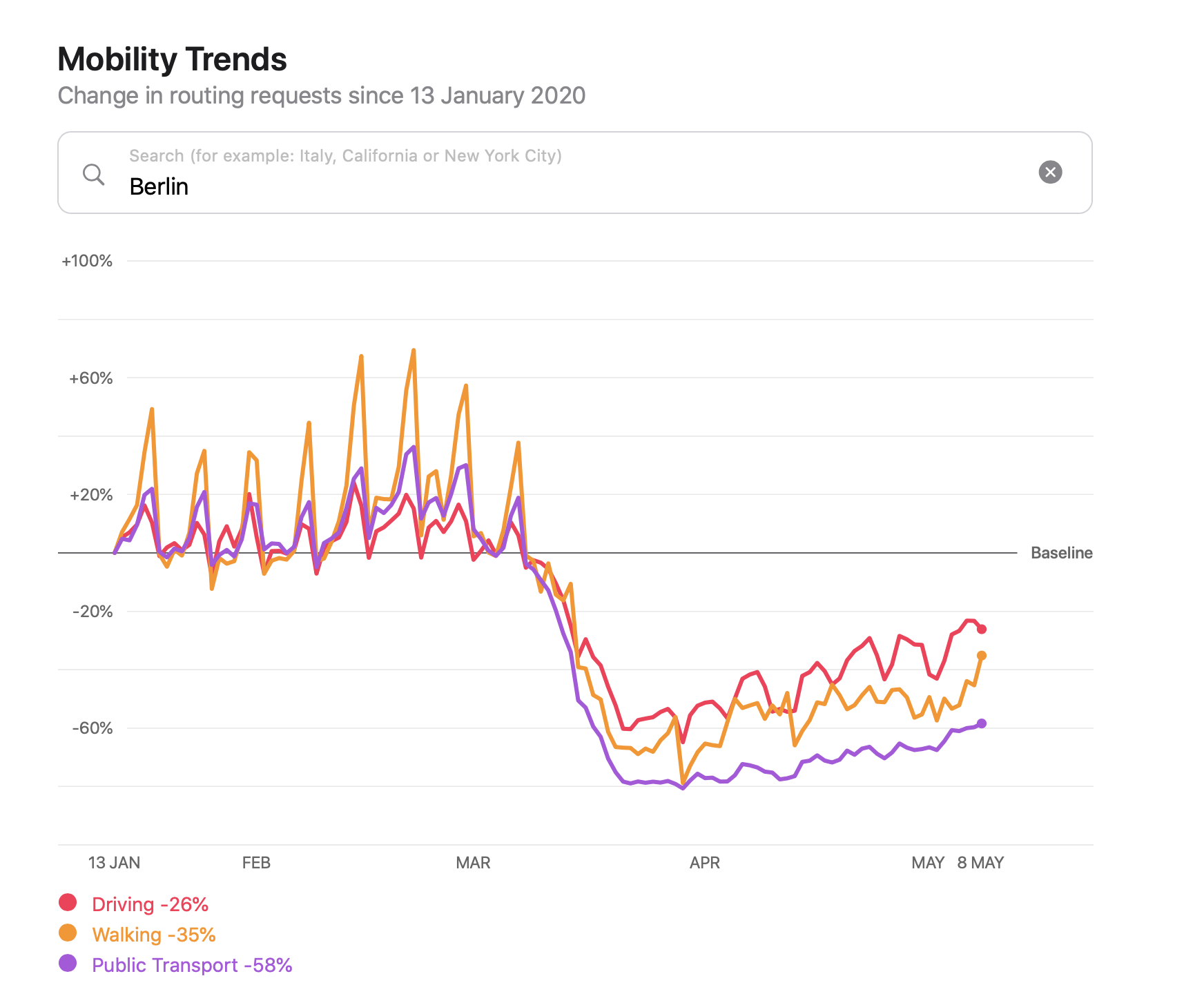
Apple’s mobility trend reports show how human mobility has changed in countries and cities worldwide since January 2020 and are basedon location data of Apple’s “maps” services. It is designed to help mitigate the spread of COVID-19, provide governments, research institutions, health authorities, and the general public with insights on the effects on human mobility of national and regional lockdown policies. The data covers 63 countries, 530 provinces and all major cities worldwide, and are generated by counting users’ requests for directions in the app. All data are shared on an aggregated level and Apple does not keep a history of users’ mobility behaviour.
Results
All data and graphs of Apple’s mobility trend reports are shared online on a daily basis. They specify three forms of mobility: Driving, walking and public transport. This information can be combined with other external data to gain further insights on whether these specific forms of movement were reduced/increased following the measurements implemented at various governmental levels. Overall, these innovative data show how private sector data can offer valuable insights for public policy making, serving the good of societies worldwide. Furthermore, the reports allow for an open and inclusive access to anyones interested in conducting and replicating this type of research using the publicly available data.
(Image: © Apple)


