Using visible infrared imaging to detect movement and blackout conditions in Aleppo
Summary
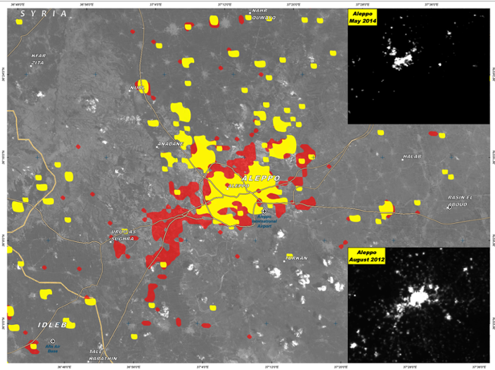
As one of the early experiments with satellite imagery, this project from 2014 sought to detect population movements within a city, more specifically, Aleppo, Syria. The team illustrated areas of visible light at night on two different dates in 2012 and 2014 to identify where electricity supply was destroyed during the violent conflicts. This approach helped to identify specific areas heavily affected by housing destructions, suggesting increased numbers of forced displacements.
Results
The areas that were likely to be experiencing blackouts in May 2014 were indicated in red – these are the areas that were lit at night in August 2012 but remained dark after more than a year of heavy fighting. This includes large areas of the city of Aleppo as well as multiple outlying towns and villages. Conversely, the yellow areas illustrate areas that still showed light at night in May 2014. Overall, this is an early innovative approach to use satellite imagery that provides insights for identifying local regions with an increased outflow of forcibly displaced people. Potentially, it can still be replicated in various other contexts of forced migration; however, as technology evolved further satellite data are capable to produce imagery of better resolution by now, useful to estimate displaced populations more accurately.
(Picture: © UNITAR)


